Nakhtarana Fm
Type Locality and Naming
SUBSURFACE. Well GK-1-1, interval 1900-2025 m. [Original Publication: Zutshi, P.L., Mittal, S.K and Shah, L. (1993) Lithostratigraphy of Indian Petroliferous Basins, Document IV, Kutch Saurashtra Basin, KDMIPE, ONGC Publication, pp 1-50.]
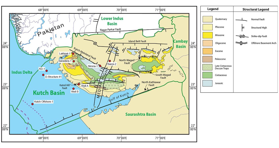
[Fig. Geological and structural map of Kutch, also showing the onshore and offshore wells drilled for oil exploration. (Map by Rasoul Sorkhabi in GeoExpro Dec2014, based on various sources including S.K. Biswas, Current Science, 25May2005)]
Lithology and Thickness
Limestone to Sandstone. In type section it is 512 m; over the Kutch thickness varies from 6 to 410 m. Three members are identified:
1) Nakhtarana Limestone Member: Consists of white buff, fossiliferous compact limestone along with alternations of siltstones;
2) Nora Member: Claystone litho-units with minor basalts and fine-grained sandstone;
3) Anjar Member: Dominantly sandstone litho-units and comprises shale-sandstone alterations in lower part.
Relationships and Distribution
Lower contact
Unconformable with Deccan Traps Fm in Kutch shelf, expecting the well KI-1A where it is unconformably underlain by Kori Fm.
Upper contact
Unconformable with Jakhau Fm.
Regional extent
GeoJSON
Fossils
Nummulites – Lockhartia biofaceis, Nummulites ranikothalia, Discocyclina, P. pseudomenardii; M. miscella
Age
Depositional setting
Inner shelf environment, lower part of the formation in KD-1 and GKH-1 wells barren of fauna and deposited in non-marine to marginal marine environment.
Additional Information
